Jilin—1 GF07 satellite transmits high-resolution photo of Harbin's winter wonderland


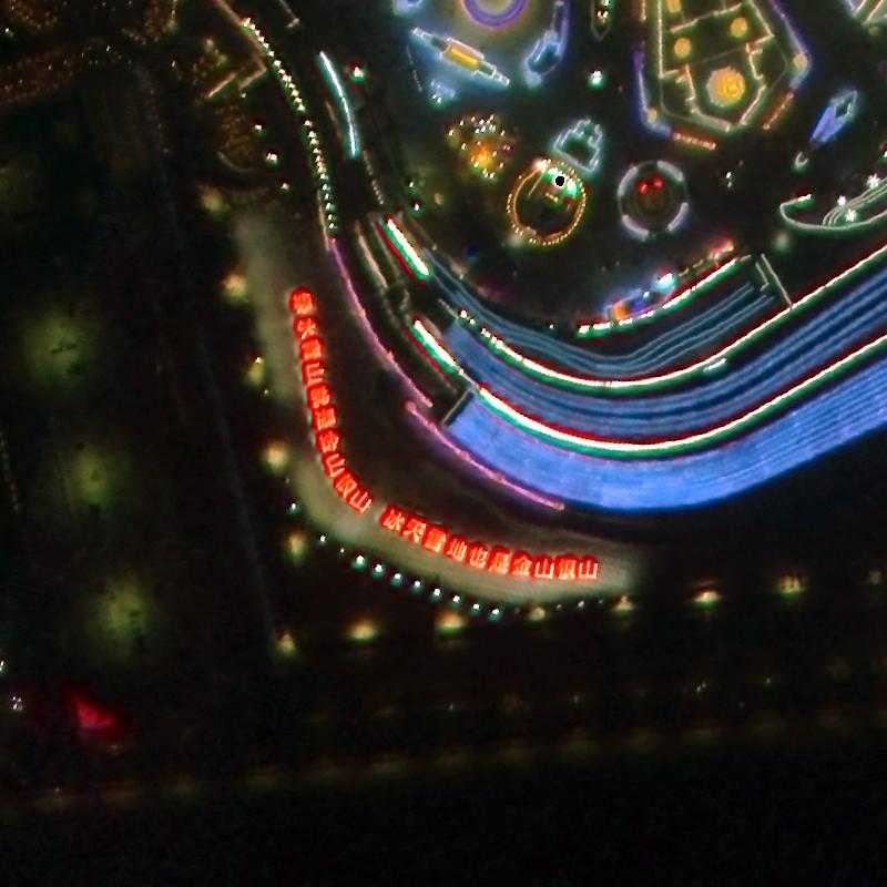
The Jilin—1 GF07 satellite recently transmitted a picture of Heilongjiang province's Harbin Ice and Snow World Park on New Year's Eve, China's first very high-resolution color night-time remote sensing satellite image.
The Jilin—1 GF07 is part of the Jilin-1 satellite family developed by Changguang Satellite Technology based in Changchun, Jilin province. The technology is China's first domestic remote-sensing satellite constellation for commercial purposes. It produces super high-definition images and provides information on various conditions, including forest fires, desertification, offshore rescue, and ocean protection. It can capture artificial light sources on the Earth's surface at night and image low-light areas, providing unique social, economic, and environmental data.


- People-centered approach upheld
- Search and rescue ops in Liuyang nearly over as death toll rises to 37
- Fujian seeks to spur cross-Strait business
- HK's potential as global mediation capital highlighted
- Changsha metro station provides luggage storage for holiday
- Access to apps reshaping healthcare in Shandong